


balade tour du Mont fol

raab
User
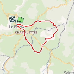

Length
12.7 km

Max alt
1481 m

Uphill gradient
376 m
Km-Effort
17.7 km

Min alt
1183 m

Downhill gradient
377 m
Boucle
Yes
Creation date :
2018-08-14 07:34:09.252
Updated on :
2018-08-14 11:19:21.228
3h43
Difficulty : Easy

FREE GPS app for hiking
 SityTrail
IGN / Geographical institutes
SityTrail Plus
The world is yours!
About
Trail Walking of 12.7 km to be discovered at Auvergne-Rhône-Alpes, Ardèche, Le Béage. This trail is proposed by raab.
Positioning
Country:
France
Region :
Auvergne-Rhône-Alpes
Department/Province :
Ardèche
Municipality :
Le Béage
Location:
Unknown
Start:(Dec)
Start:(UTM)
588428 ; 4966775 (31T) N.
Comments